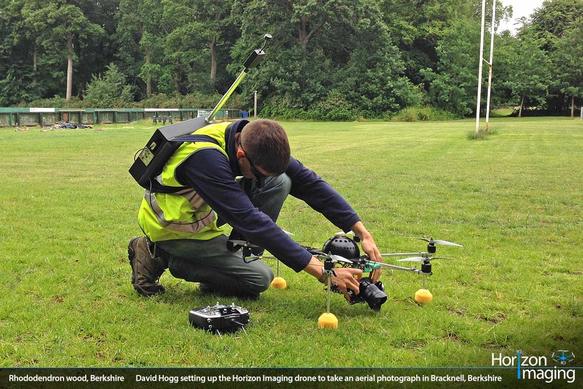
Horizon Imaging was recently commissioned to take an aerial photograph of a patch of woodland in Bracknell, Berkshire, for the local council as it is home to a unique population of rhododendron plants. Taking off from a neighbouring rugby pitch, our drone was flown up to 400 feet (its maximum permissible altitude) and captured a range of different overview photographs of the woodland, one of which is shown on the right. As well as providing an interesting viewpoint of the woodland, this image will primarily be used on an information board in the visitor’s car park – overlaid with boundaries, footpaths and areas of interest.
The aerial photography shoot was due to take place on the 19th June, but on checking the NOTAM map a few days before, it was decided to postpone the shoot until the following week. A ‘NOTAM’ is a ‘NOTice to AirMen’ – a notice filed with the Civil Aviation Authority (in the UK) detailing areas of potentially hazardous activities which could affect the safety of other air users. As it happened, the 19th June was right in the middle of the horse races at nearby Ascot Racecourse, and the whole area was criss-crossed by low-flying helicopter routes. Whilst we could have created our own NOTAM outlining our plans to fly a UAS (Unmanned Aerial System) over Bracknell, such was the density of the helicopter flying routes in the area that it was decided to postpone the shoot until the races had finished the following week.
Awareness of systems such as the NOTAMs is another reason why you should only work with drone aerial photography companies who are fully licensed, insured and trained in the safe operation of UAS’ – other operators who are not familiar with the rules and regulations may well have turned up and flown without checking the NOTAM map, which in this case could have led to a potential mid-air collision with a full-size helicopter.
Do you have a large project or site which you need photographed from the air? Call us today for a chat and we will be happy to discuss your requirements with you.


