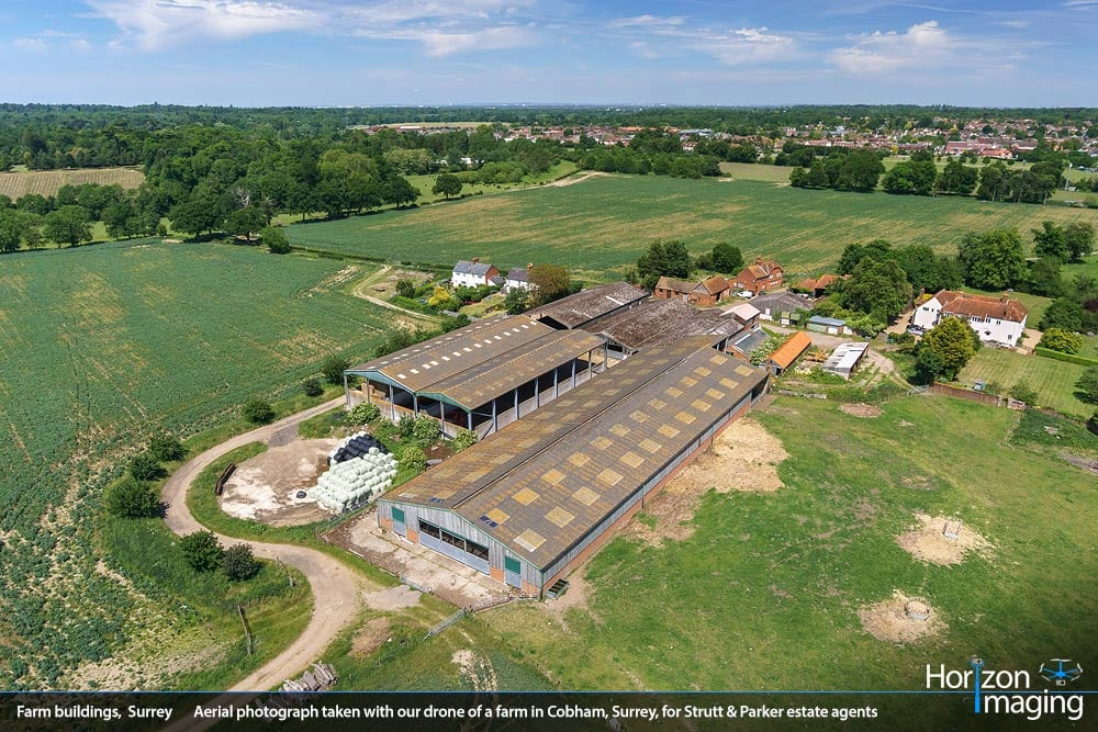
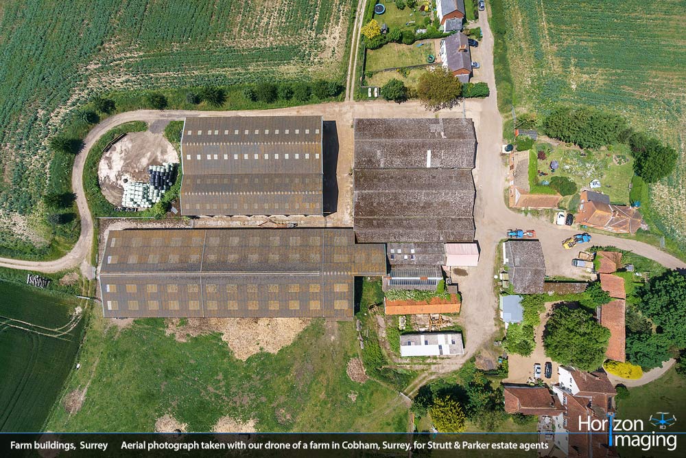
Horizon Imaging was recently commissioned to take a set of aerial photographs of a number of farm buildings in Cobham, Surrey for Strutt & Parker Estate Agents.
This was one of those shoots where the size and scale of the properties would have been impossible to comprehend in a single photograph – unless it was taken from the air. These properties cover a significant area of ground, and the client requested to have them photographed in their entirety from a number of different angles to show how they sit within the surrounding landscape. The flexibility of our drone meant that a large number of angles could be captured in one flight – like the two images shown on the right.
The client was thrilled with the resulting imagery and recently sent us the following kind testimonial:
“We commissioned Horizon Imaging to take some aerial photographs of some of our client’s properties. The resulting images looked fantastic and really helped us to see how the properties sit in their surroundings. We highly recommend Horizon Imaging’s services and we will be using them again soon.”
Are you struggling to capture the extent of your properties from ground level? Is it important to clearly show how your properties relate to the surrounding environment? Have you heard about drone aerial photography but aren’t quite sure what the process involves? Then give us a call today and we will explain how simple and affordable it can be!


